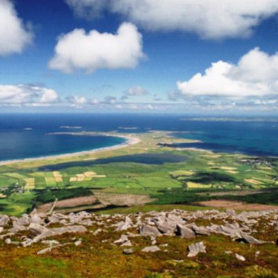
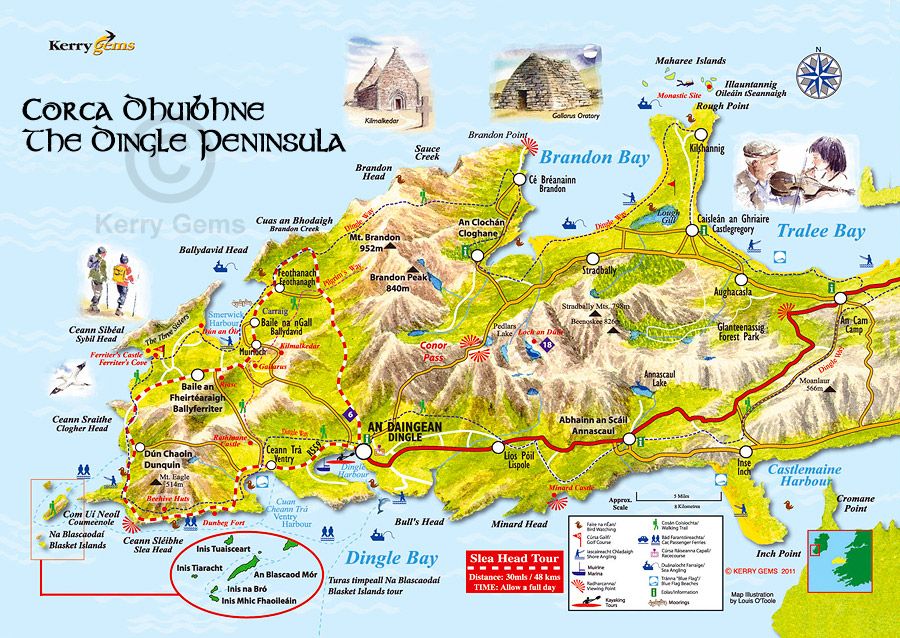
The Maharees AreaStretching 5kms northwards into the Atlantic on the lee shore of the Dingle Peninsula, is a unique and special peninsula known as The Maharees - Na Machairí. Separating Brandon Bay from Tralee Bay, The Maharees tombola or sandy spit consists of sand dunes and wild beautiful beaches for much of its length and has a world-renowned reputation for its superb coastline, blue flag beaches, and large Atlantic swells.
Three villages or settlements, Fahamore, Kilshannig, and Candiha cluster on the earth and rocky ground around Scraggane Bay at the north end. At the tip lies Rough Point and out to sea across the Maharees Sound lie a cluster of uninhabited islands known as the Seven Hogs. The whole area of The Maharees lies low on the horizon with most of the peninsula close to sea level creating a special light and atmosphere. A place of exceptional beauty, with its long uninterrupted beaches and dune system, The Maharees offers a wide variety of water activities such as surfing, windsurfing, waterskiing, kiteboarding, scuba diving, angling and canoeing. Equipment and instruction are available locally with all levels of experience catered for, a perfect day out for families wanting a fun or adventurous experience. For land based activities, try pony trekking along the beach or enjoy glorious walks on mile upon mile of white sandy beaches.
|
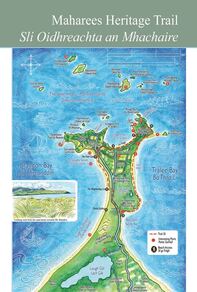
Maharees Heritage TrailThe long history and scenic wonders of the Maharees – along with less obvious scenes of piracy and shipwrecks – will be charted in the Maharees Heritage Trail. The trail, which follows the outline of the outermost part of the Maharees peninsula, runs from Béal Geal (Sandy Bay) to the tSean Abhainn river that flows from Lough Gill, providing a source of fresh water over the long centuries that the Maharees has been inhabited.
Although The Maharees is now more commonly known as a summer retreat for caravanning holidaymakers, the heritage trail reveals that it has a very long and fascinating history, going back to the 5th Century monastic site at Oileán tSeannaigh founded by Saint Seanach. In more recent times, many ships met their end off the Maharees, including the Nuestra Senora del Socorro of the Spanish Armada, various cargo vessels and the unfortunate East Indiaman ‘York’ which was wrecked by pirates in 1758. The flora and fauna of the fragile peninsula, which is listed as a Special Area of Conservation, is also outlined along the trail on signs beautifully illustrated by West Kerry artist Domhnall Ó Bric. Click on this link for google maps directions to start of walk www.google.ie/maps/dir/Castlegregory,+Martramane,+Co.+Kerry/52.2806163,-10.0253895/@52.2791124,-10.0299034,16.4z (Car parking is available. Roads are quite rural and narrow so caution is advised.) click on this link for an outline of the walk itself https://www.plotaroute.com/route/968028 A pocket size map with interesting facts is available from Castlegregoy Information Centre in Castlegregoery, V92 FH32 |
Food & Dining
|
Dingle Town & Surrounding AreaDingle town is a 20 minute drive from Maharees. You travel over the stunning beautiful Conors Pass. Dingle Town hosts a wide range of daily activities. There is a huge variety of pubs and restaurants to visit while there. Visit https://dingle-peninsula.ie/ to find our more.
|


